One real group ride, start to finish, in the order a ride leader actually builds it. Every
screen below is a capture of this ride — nothing staged, nothing mocked up.
210.6 mi · 6 stops · twisty pace · 5h 46m riding ·
9:00 AM to 5:06 PM.
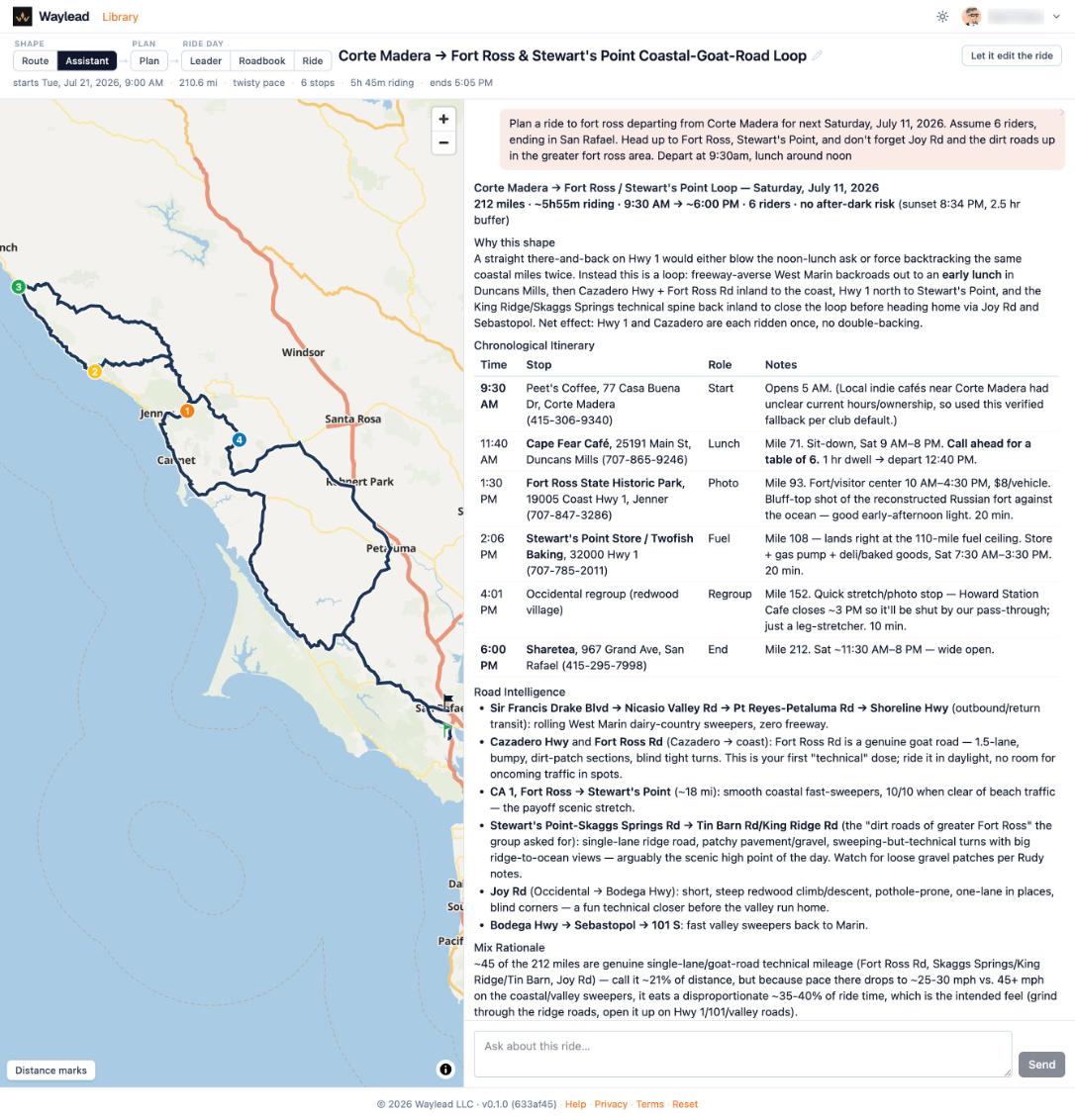
“Head up to Fort Ross, Stewart’s Point, and don’t forget Joy Rd
and the dirt roads up in the greater fort ross area.” — the request that
produced everything below.
It started with one sentence
The request, and the itinerary it produced — stops with times, roles and reasoning,
then road intelligence for each leg.
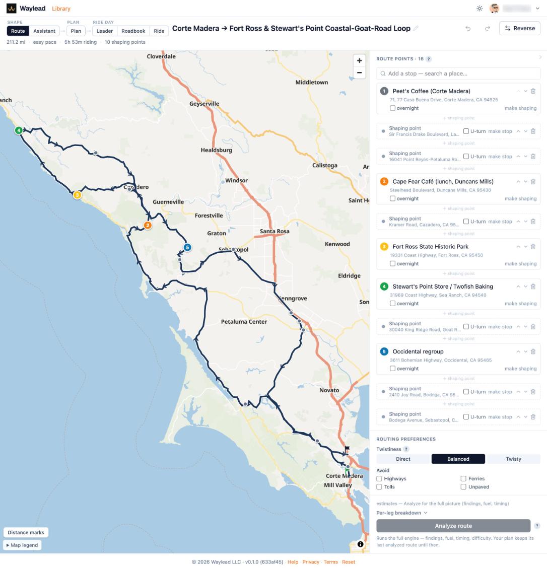
Then it becomes a real line on real roads
The matched
route with its shaping points — the minimum needed to hold the intended
shape.
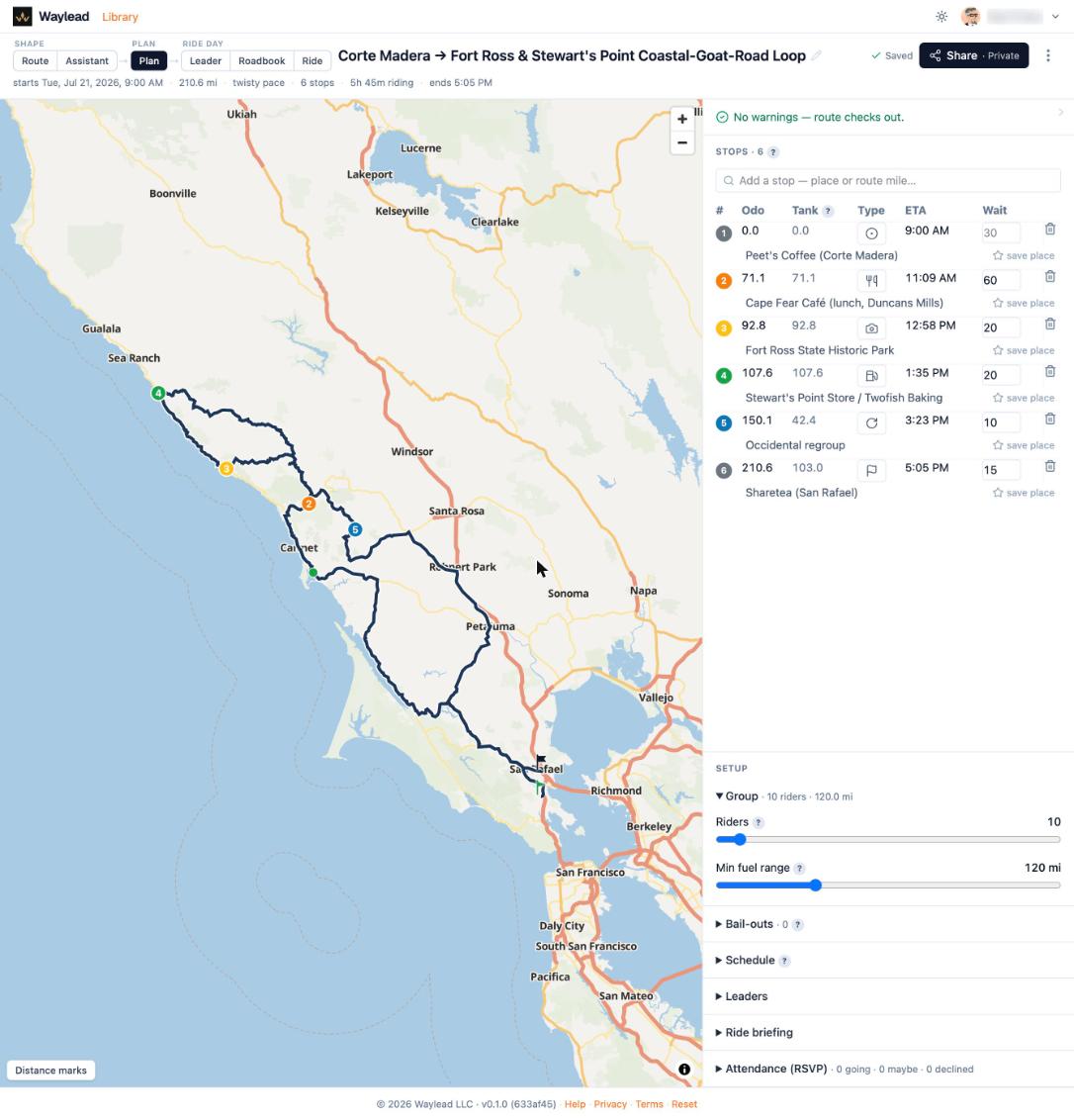
The ride gets checked before you commit to it
Stops, ETAs and
dwell, with the one finding this ride raised — FIRE at mile 173.1, about 4 mi off
route.
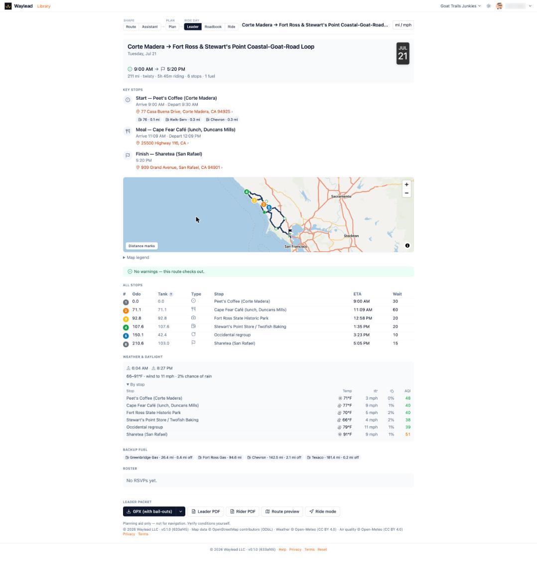
You leave with the packet, not a screenshot
The
co-leader view end to end — key stops, map, weather and AQI per stop, backup fuel,
roster, downloads.A
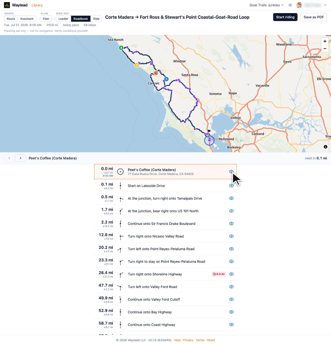
mile-ordered cue sheet with tulip turn glyphs, and a Street View link at each decision
point.
Your riders just get a link
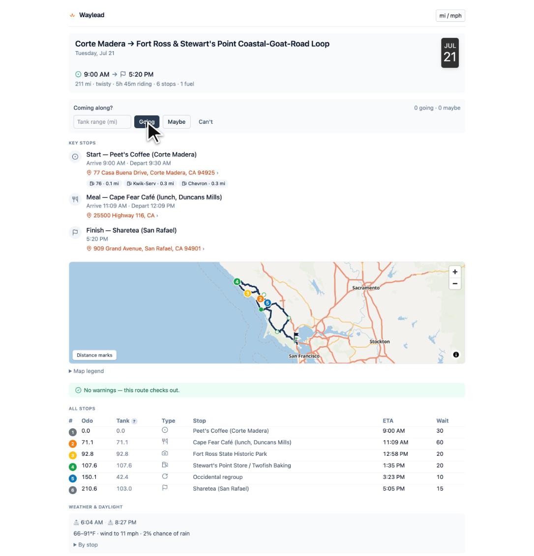
What a
rider opens from the share link — map, key stops, ETAs, weather, and RSVP. No PII,
no account.
And on the day, it comes with you
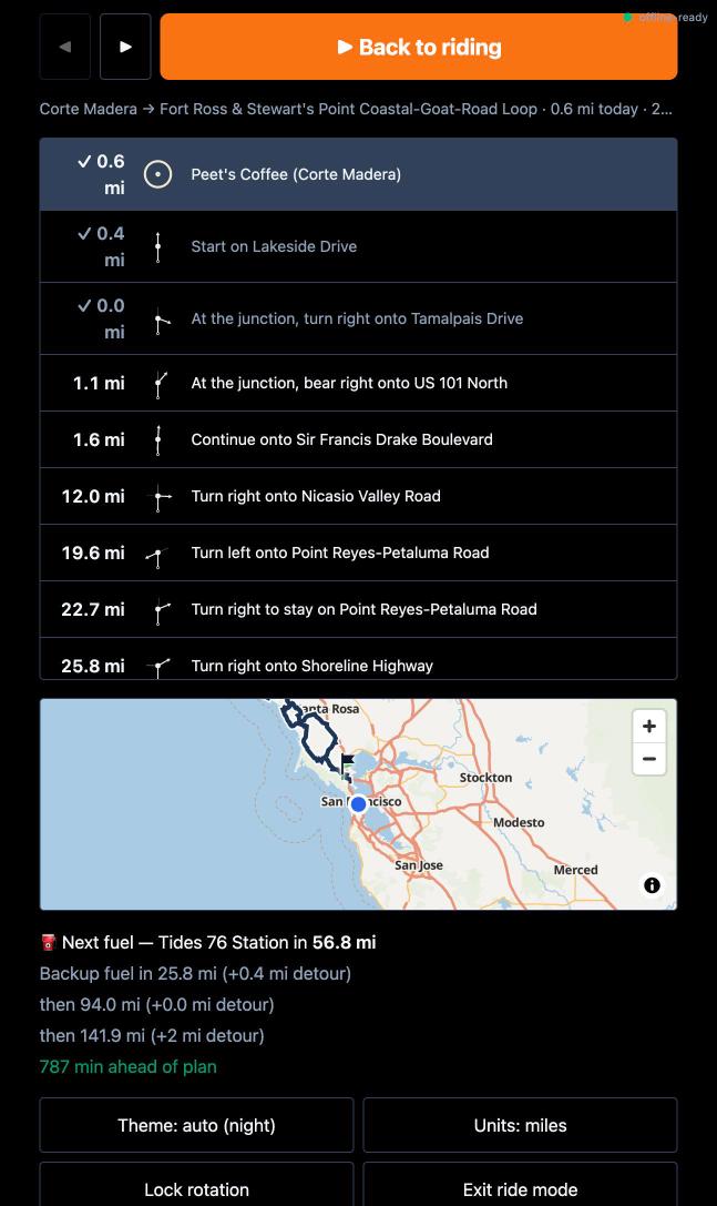
Miles to the next cue, its tulip glyph and the road it puts you on, and the
one after it.The cue list with live position, next fuel, backup-fuel gaps, and pace
against the plan.